|
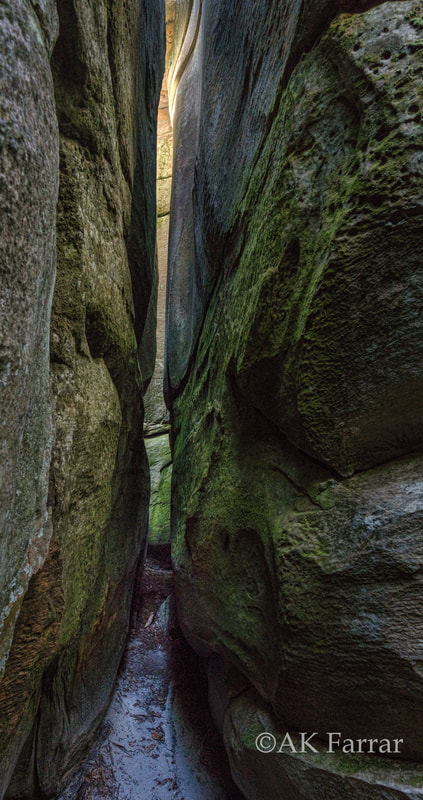
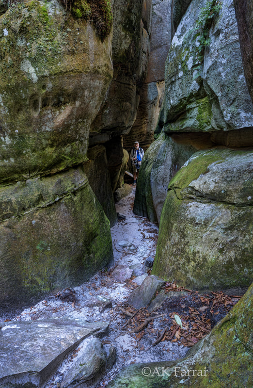
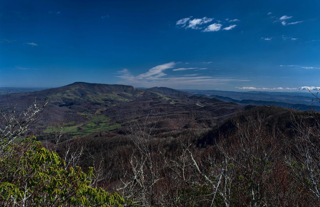
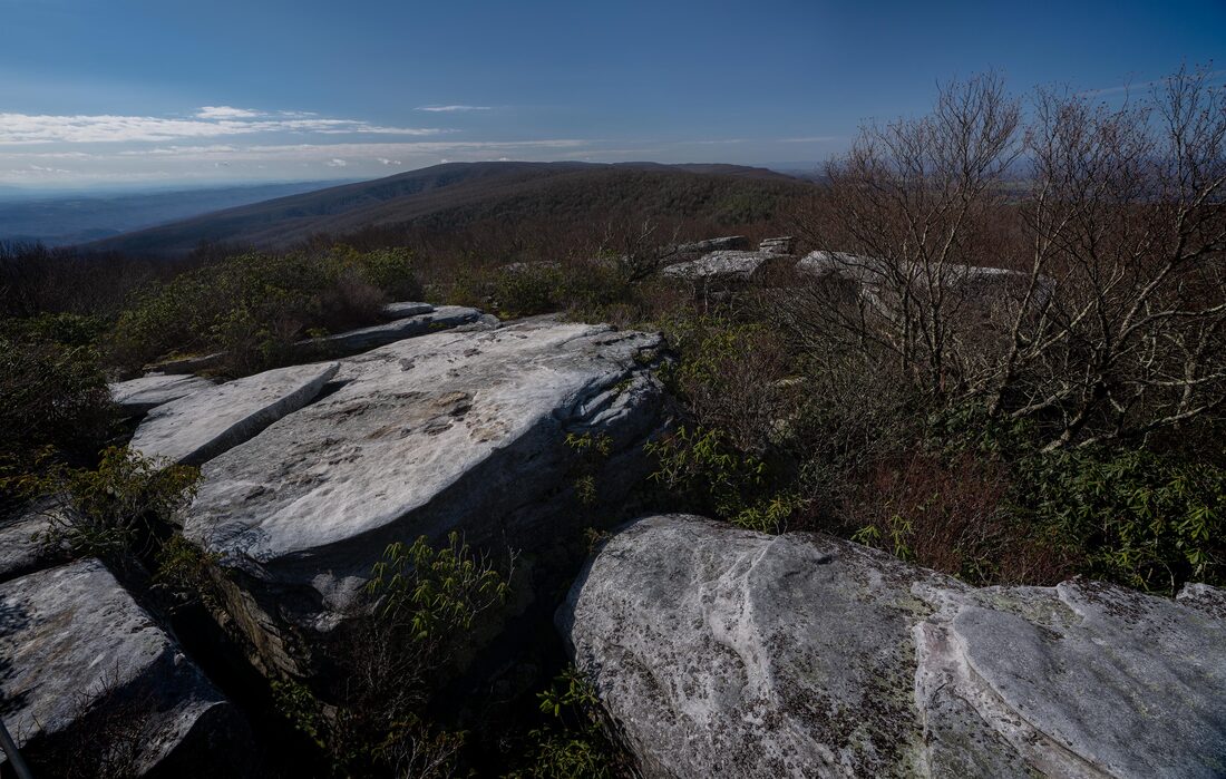
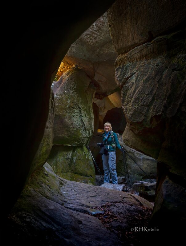
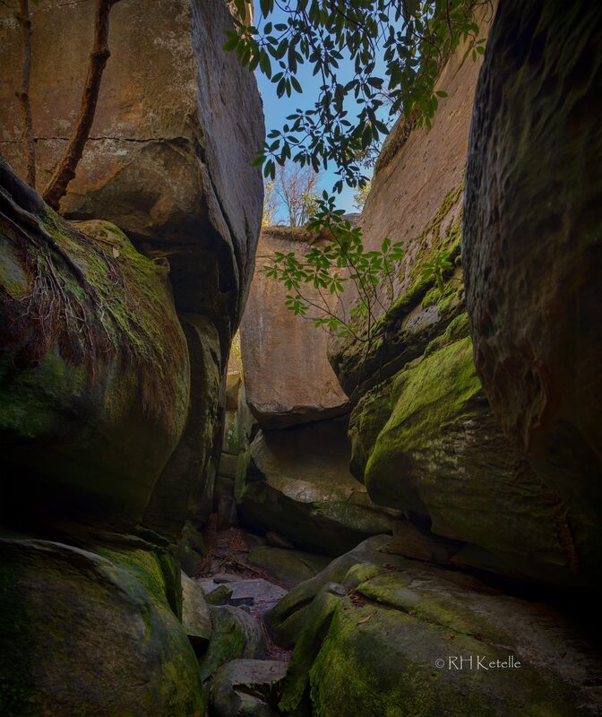
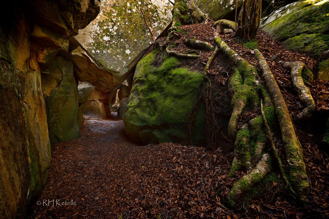
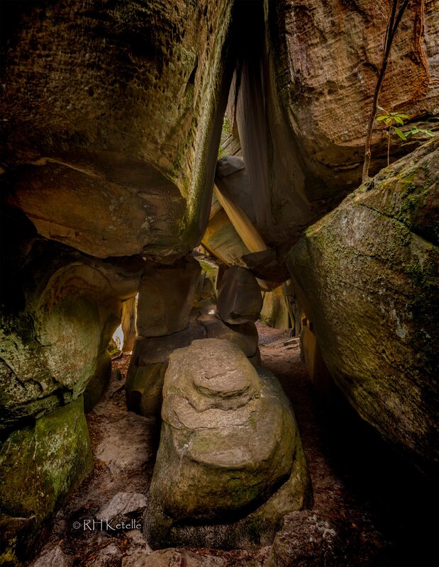
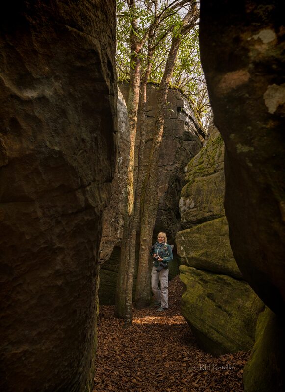
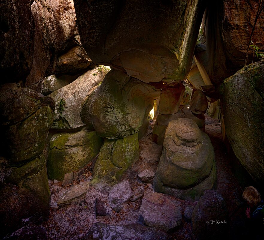
By Ann Farrar and Dick Ketelle We explored a new area to us a couple days ago -- the Channels State Forest. It is on State Hwy 80 in southwest Virginia. The Virginia Department of Forestry purchased this land from The Nature Conservancy (TNC) in 2008. TNC had purchased the property a few years earlier for the purpose of protecting and conserving this resource. Within the boundary of the ~4,800-acre property is a 721-acre parcel that has been dedicated as the Channels Natural Area Preserve under the provisions of the Natural Area Preserve Act of 1989 to be managed by the Department of forestry in partnership with the Department of Conservation and Recreation. 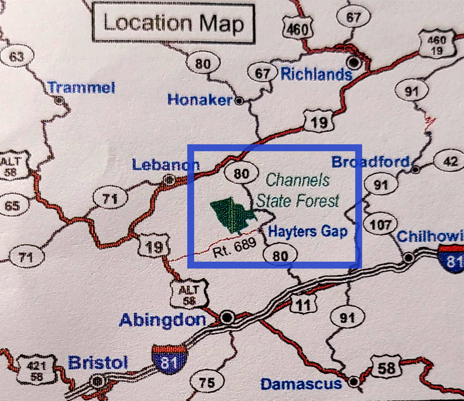 The area highlighted in blue, in the map above, shows the location of Channels State Forest on Hwy 80. 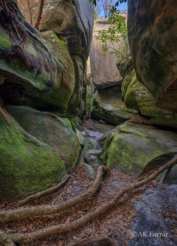 The preserve name is derived from the maze-like system of sandstone crevices and boulders that occur near the summit of Middle Knob on Clinch Mountain. The Channels were likely formed while the high-elevation sandstone cap was under the influence of permafrost and ice wedging during the last ice age. These forces shattered and enlarged joints in the sandstone caprock. As you can image, Dick was "in his element" examining and exploring the maze!! It brought back memories to both of us of scrambling through Mahoosuc Notch on the Appalachian Trail in Maine. 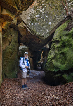 The hike to The Channels is about 3 miles (6 miles roundtrip) and ~1,200' of elevation gain on the Brumley Mountain Trail. The trailhead is at the top of the mountain on Hwy 80. On the trail, you will pass an old fire tower, no longer accessible, before the rock maze entrance. Once in The Channels, we probably spent a couple hours walking around, taking pictures, and enjoying lunch on top of one of the giant boulders in the sunshine. We had so much fun exploring the maze!!! 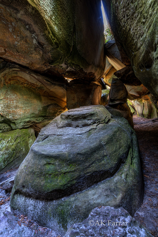 There is a small parking lot at the trailhead and no parking is allowed on the road. We arrived in the morning and had no problem finding a parking place, but it was more crowded in the afternoon. There area is only open during daylight hours, and it seems to be enforced with monitoring at the trailhead later in the day. "Leave no trace" is practiced at this location; no restrooms or trash containers are available
Our Journey to Middle Earthby Ann Farrar Dick has been a Volunteer Trail Maintainer for most of his life. I became an AT Trail Maintainer after the first National Trails Day in the Smokies, right after I started section hiking the AT. [In fact, Dick and I met while maintaining the AT, but that is a story for another blog post!!] I am no longer able to do any of the hard work, because of my back, but I can take pictures of all the hard work that is accomplished, paint blazes, and cut back small branches. I always enjoy being out hiking on the trail and giving back, even in a small way. This past Sunday I went with Taylor Weatherbee and Dick, both volunteers and certified Sawyers, as they removed A LOT of blowdowns on the AT in the Nantahala National Forest. [NOTE: The Smoky Mountains Hiking Club, SMHC, is responsible for volunteer trail maintenance of 100 miles of trail in the Great Smoky Mountains National Park and the national forest.] The three of us were on the AT between Wright Gap and the Jump Up. 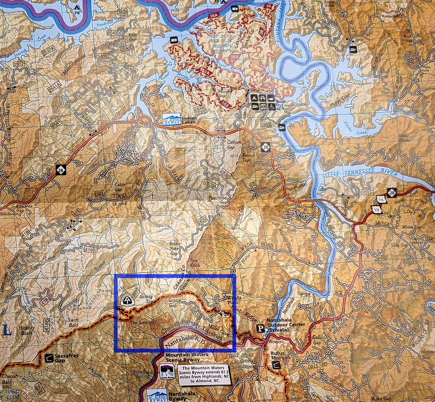 The area highlighted in blue, in the map above, is the section we were hiking and clearing. This post includes pictures and a video from just a few of the blowdowns they removed. They completed a TON of work and were thanked by all the AT South bounders we met while working. It was a great day in the mountains, including having lunch on the Jump Up and enjoying the fantastic view!! 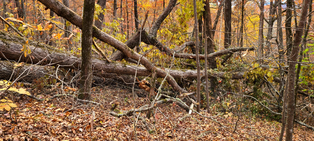 This is the "before" picture of the biggest mess they had to clear from the trail. And yes, the trail goes right through the middle of this massive blowdown of at least four BIG oak trees! If any of you are familiar with this section of the AT, this mess was within sight of the Grassy Gap backcountry campsite. 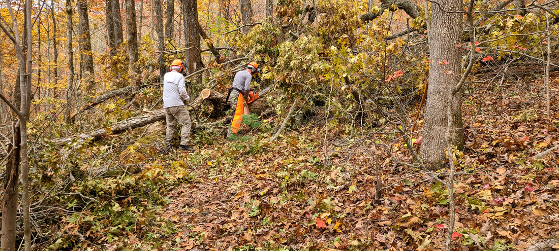 Whenever we reached an area to clear, we stopped and the two of them talked about their plan while getting out their gear and getting ready. They had one chainsaw on this trip and took turns using the saw, while the other moved the cut branches out of the way. Taylor is using the saw in this picture while Dick removes the cut branches and debris. Note that the Sawyer always wears chaps, and they both wear hard hats with face and ear protection. The Sawyer also wears long sleeves while sawing. 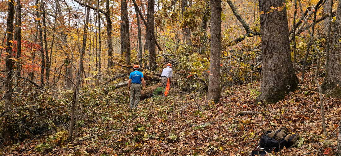 Now Dick is using the saw while Taylor removes debris. They switch often to give each other a break from each job. 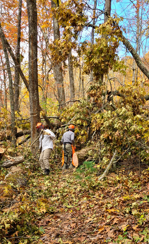 This was the first time I had hiked with Dick and Taylor while working. I was really impressed with how well they work together clearing the trail. 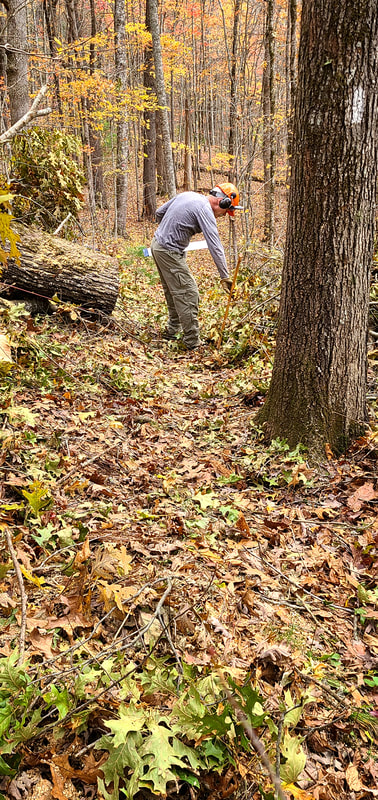 Finally, the trail is clear!! It doesn't even look like the same place! The picture is taken from the southbound side of the AT, while the "before" picture was taken from the northbound side of the trail. Great work guys!!! 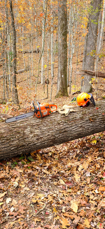 One of the things I did was scout ahead to see if there were other blowdowns close by. That way they knew if they should just carry their gear to the next work site, instead of loading up their packs. I didn't have to go very far to find this one. It was about 100 yards from the last big mess. They rested their saw on the log while going back to get their packs and other gear. 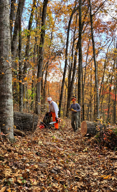 After the last blowdown, this one went very quickly. The trail is clear again!! 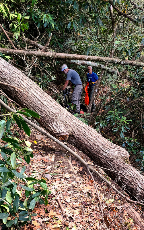 There were too many blowdowns to capture all of them for this blog post, but this one was close to the Jump Up and especially interesting because of the angle on the side of the mountain and across the trail. Logs like this are fairly common on the AT since much of the trail is on mountain slopes. Dick and Taylor use wedges and angle cuts so the log sections can be rolled or levered apart. They also carry a spare bar and chain just in case things don't go as expected and a severe bind occurs. It is an education for me to hike with them and see how they tackle different problems. 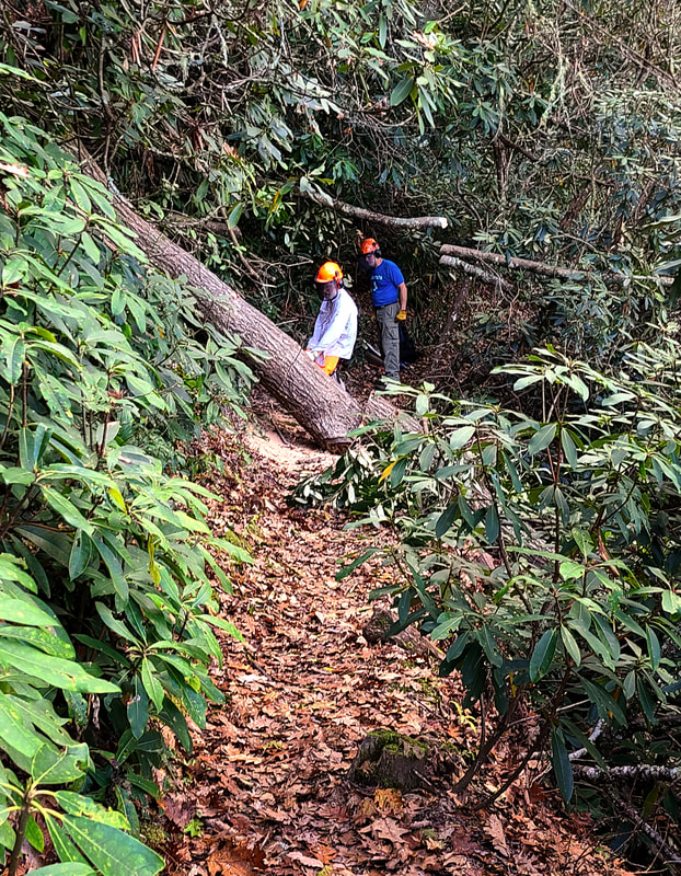 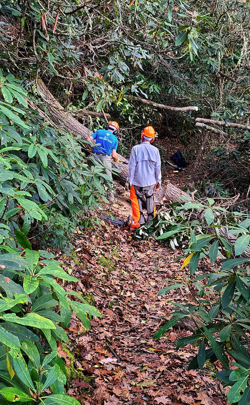 They had to use their chain saw, wedges, and an ax to get this log off the trail. 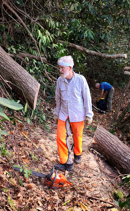 It is always a good feeling to walk through the open trail again!!! 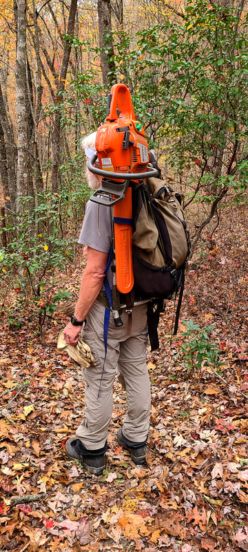 Many have asked how the saw is carried into remote sections of the trail. So this is how you carry your chain saw on the trail!!! Click on this video to watch Taylor and Dick in action!!! 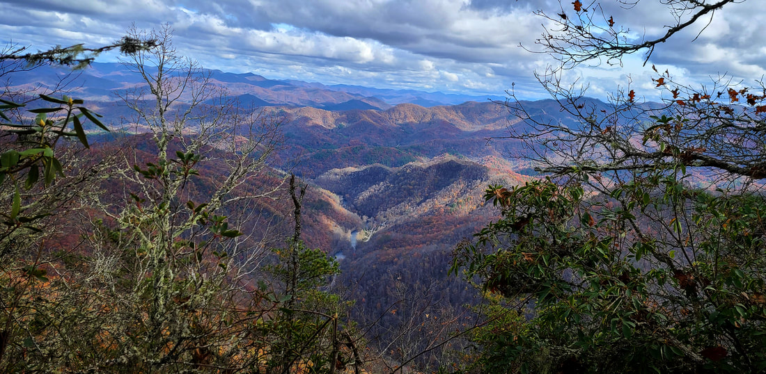 We took a break mid-day to enjoy lunch and the view from the Jump Up. It was an awesome day with an awesome amount of work completed. Thanks to all the trail maintainers for all your hard work!!!
|