|
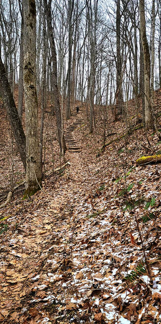
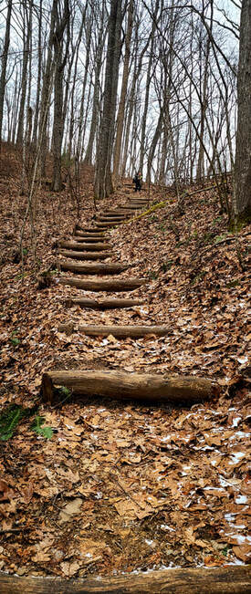
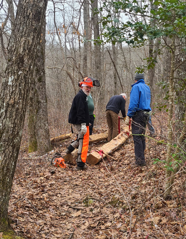
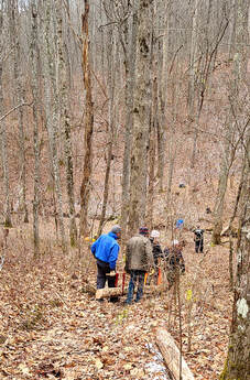
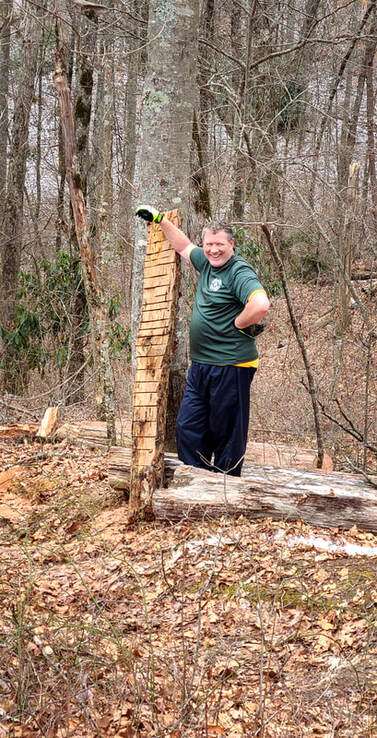
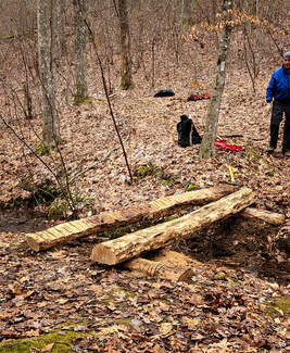
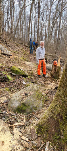
by Ann Farrar I love hiking on the AT (actually, I love hiking anywhere in the mountains). In the past, I loved doing maintenance on the AT, and now I enjoy documenting the maintenance work done by many of the Smoky Mountain Hiking Club (SMHC) volunteers. I never realized how much work was involved in keeping the trail passable until I became a volunteer AT Trail Maintainer in the late 90s. The SMHC maintains 100 miles of AT – 70 miles in the Great Smoky Mountains National Park (GSMNP) and 30 miles in the Nantahala National Forest. The last Saturday in January, I went with Dick and others to replace a log bridge and remove some blowdowns on the AT in the national forest. Franklin LaFond, the SMHC AT Maintainers National Forest District Manager, coordinated the activities for the day. Dick, Franklin, Taylor Weatherbee, Bill Pyle, Randy Bullock, and Lamar Powell (Trail Name: HOPEFUL) participated in the work crew. It was a fantastic crew that got a lot of great work done, as you will see in this blog and when you hike the trail. Volunteers adopt a section of the trail to maintain and we were working on HOPEFUL’s section of trail. We started our hike from the Fontana Village Marina parking lot, hiking south on the AT, to the work location, which was just below Walker Gap 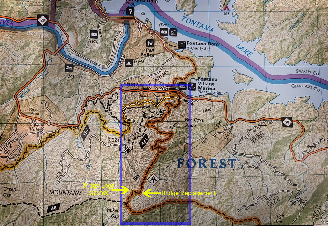 The area highlighted in blue in the map above is where we hiked in and replaced the bridge. The next map shows a satellite view of the mountains with our trailhead, route, and work location. 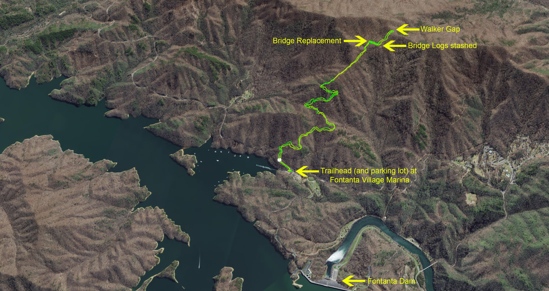
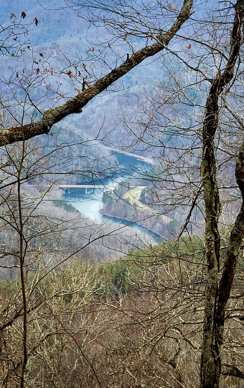
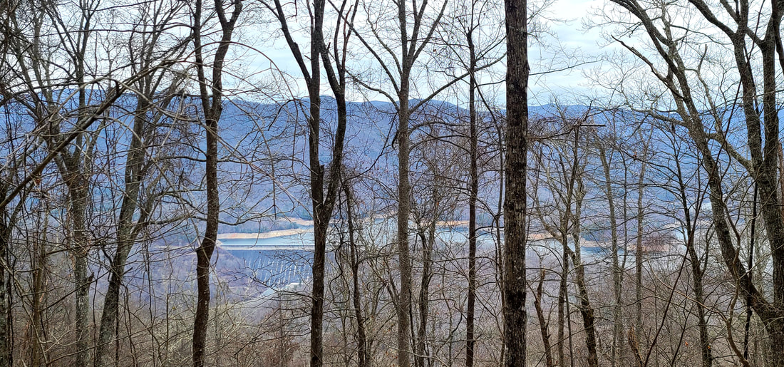
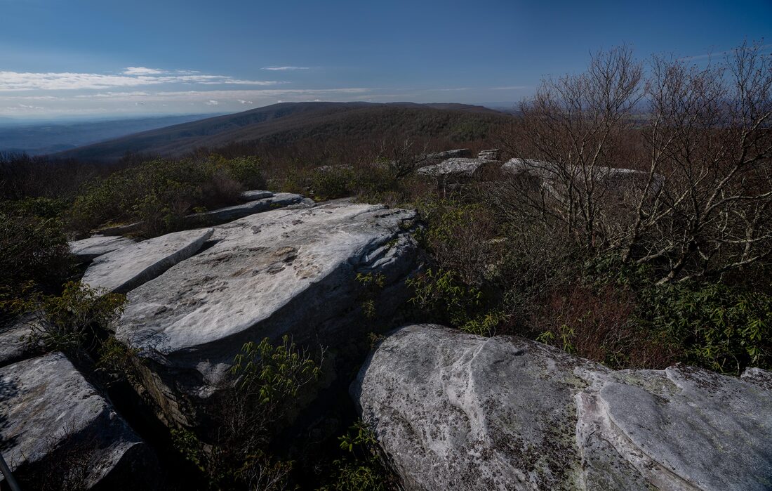
One of the things I love about hiking in the winter is seeing out since the leaves are gone. On this trip, we were able to see the Shuckstack Fire Tower, the bridge on Hwy 28 over the Little River, and Fontana Dam. 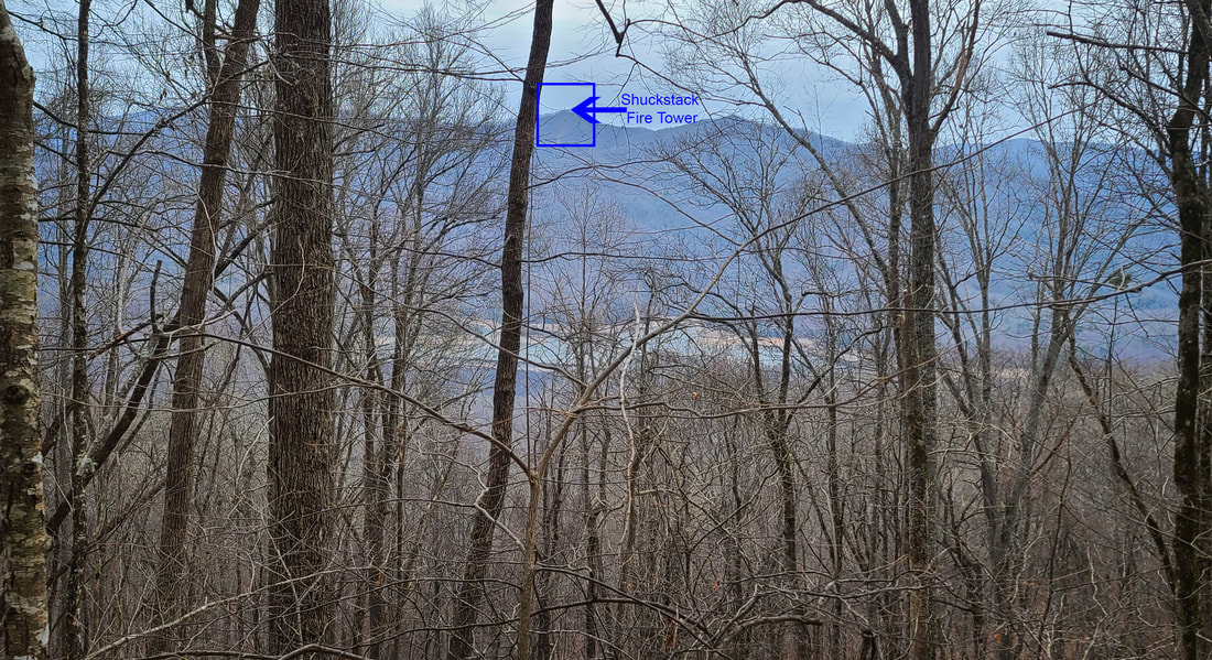
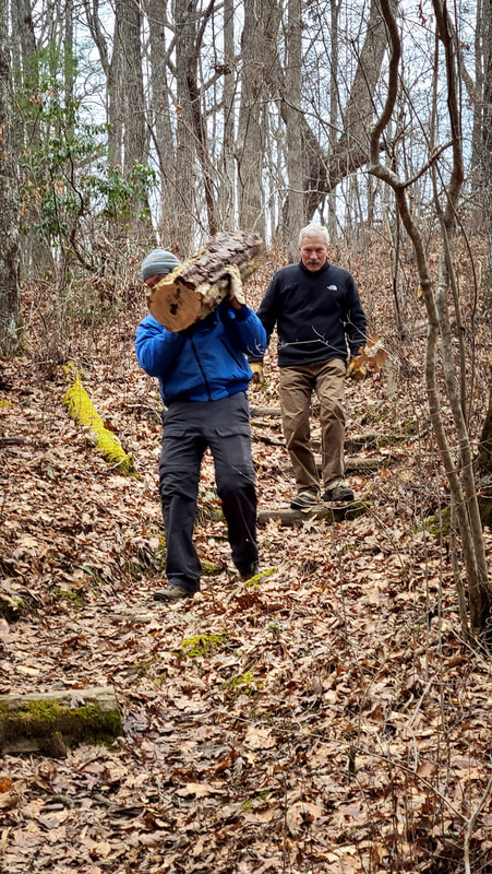
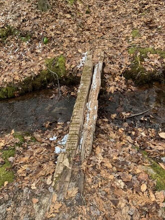 The "old" bridge: 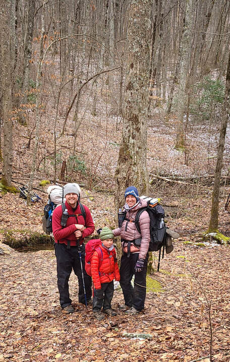 Before we started working on the bridge, the Sutton family came through -- Josh, Cassie, and "Little Man" Harvey, and they are thru-hiking the AT. You can learn more about their thru-hiking journey by following them on YouTube and Instagram. Just search for "Live Sutton" and share in their journey. They were such a delight to meet! Dick and I will definitely keep up with their progress through YouTube. And they are the last hikers to cross the old bridge, so check out that moment in the video below!! Once we arrived at the worksite, the locust logs prepped for the new bridge needed to be moved. Back in November, Franklin, Dick, Taylor, and Bill cut down a dead locust tree and prepared the logs for the bridge replacement. The tree was cut down, two big logs cut for the bridge, and two smaller logs cut for each sill log. Also, they are debarked and leveled on one side. Of course, you can’t be lucky enough to have a dead locust tree right near your construction site. Instead, they had to haul the logs down the hill. Following is a video showing how they accomplished it! They are a pretty remarkable group of guys. Bill had straps custom made to use when hauling big logs. It made getting them down the hill much easier!
Of course, if you are Franklin and Bill, and the logs aren't too big, you put them on your shoulder and carry them down!!!
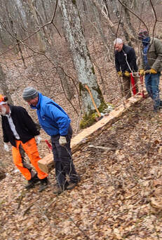
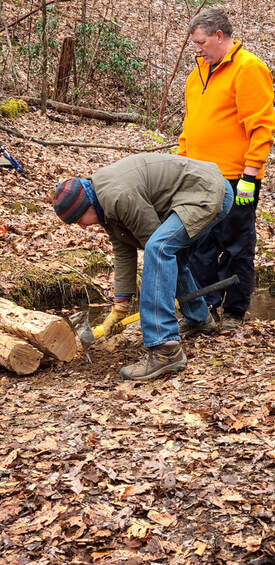
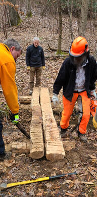
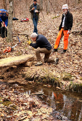
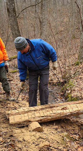
 There are so many steps to putting in a new bridge. Once all the materials are near the construction site, Franklin debarks the last log. Leaving the bark on the log increases the chance of insect infestation, which may increase the moisture leading to mold and premature rot. Next, Randy prepared the site for the sill logs so they are level in the ground. Then Taylor, Bill, and Dick tweaked it once the sill logs were in place.
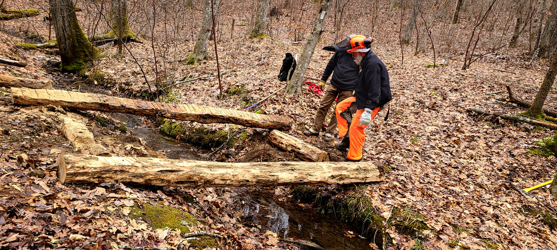
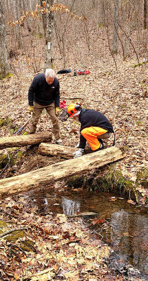
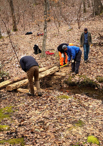
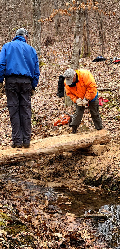
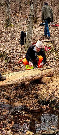
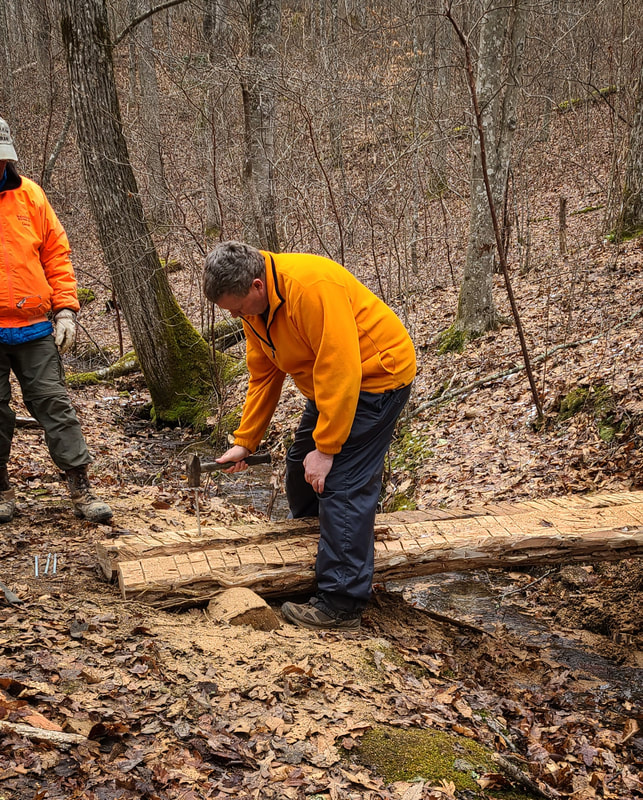
The next video shows Dick, Taylor, and Bill cutting the sill logs so the bridge logs will lay flat and level. Bet you thought we were almost finished, but NO! When they are satisfied with all the logs’ placement, LONG galvanized spikes are used to anchor the logs in place. HOPEFUL drills the holes for the spikes, Dick applies oil to the spikes, and Franklin, Taylor, and Bill pound the spikes into the logs. Whew!! What a job!!
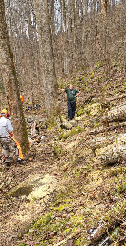
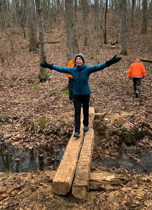 Finally, the new bridge is finished!! And what an improvement!! I was the lucky one to take the first trip across the new bridge!! Woo Hoo!!! But don’t think for a minute that their work was done. Oh no, there was a dead oak tree near the bridge and trail that was waiting to fall (called a hazard tree). In true Trail Maintainer style, the danger was averted, and the tree was cut down!! Check out this thrilling video!!! 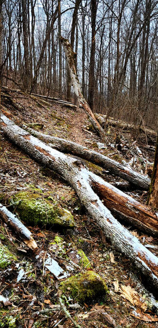 As we were hiking out, there was one remaining blowdown that needed clearing. The before picture:
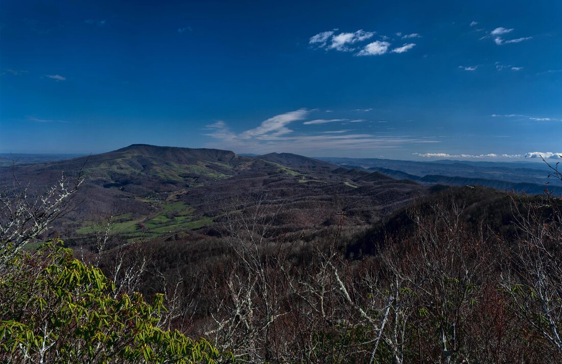
After this, everyone packed up and headed home. I can’t begin to tell you how impressed I always am with the hard-working volunteer trail maintainers. They are genuinely dedicated to doing their job safely and having a fun time while working. Everyone worked well together, and it was delightful spending the day with them! Since I cannot work on the trail any longer, this is the next best thing for me: documenting the great work they do!!! I think I have found my niche for this phase of my life as a trail maintainer because I really love being out on the AT volunteering and giving back to the hiking community. Hope you enjoy the blog and be sure and thank the volunteers when you see them out working on the trail!! If you are interested, below is a short video of our hike route, including the location of the new bridge. By Dick Ketelle Sunday January 10, 2021 was a great day for a winter hike up the Alum Cave Trail to Mt. LeConte. I have been hiking this trail each winter since the mid 1960's and it is always interesting and rewarding. This trip started just at the atmospheric inversion level where I was at the top of the wispy clouds and fog. The moisture from the cloud plus a little snow made everything white and the plants had lacy coatings of rime ice needles.    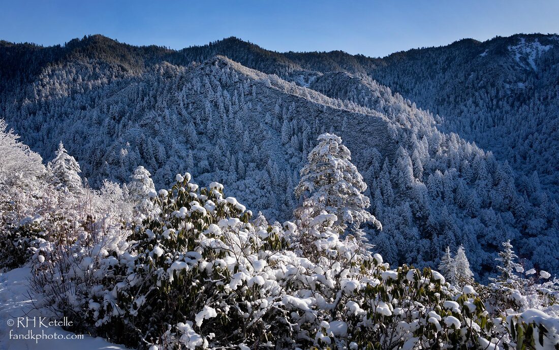 ,Once out of the frigid and shady valley floor of Alum Cave Creek and Styx Branch, the sun was shining gloriously and lighting the frosted trees of the heath-covered ridges of Huggins Hell. 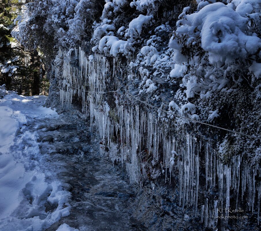 The icy ledges on the Alum Cave Trail are often beautifully decked with icicles. Some type of traction devices on one's boots is a great idea to keep the walking safe. 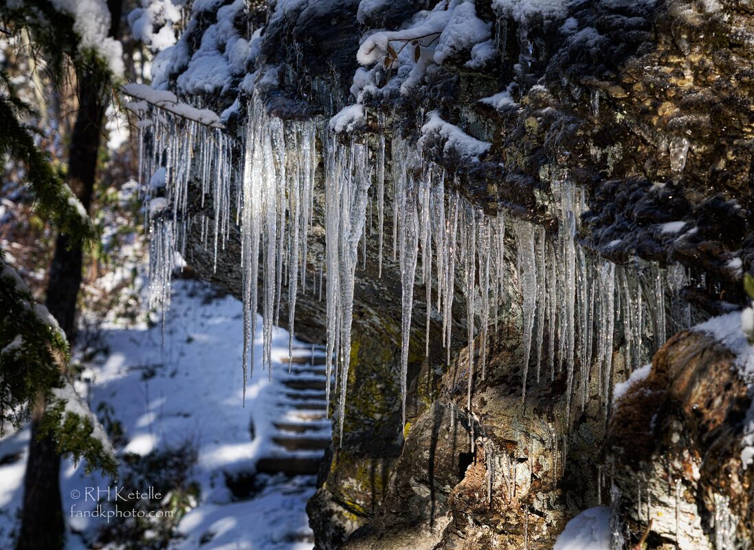 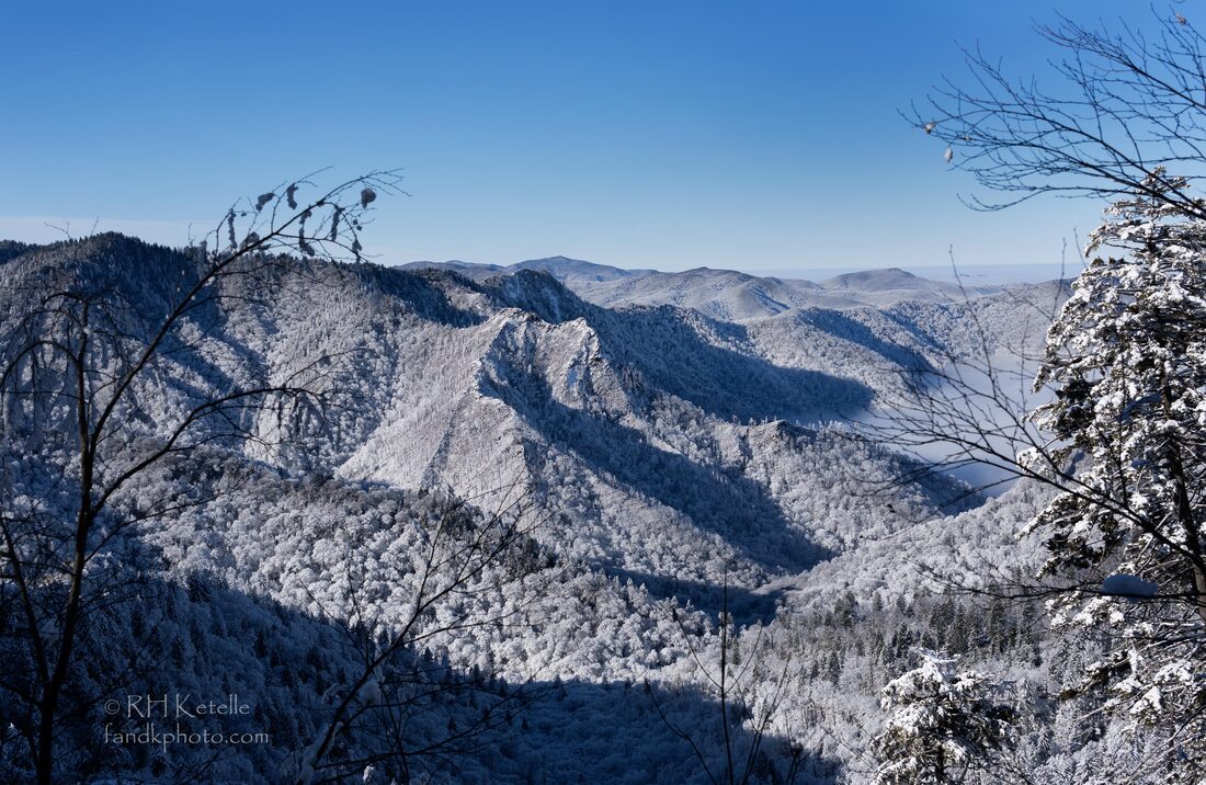 After rounding the bend above Alum Cave opportunities for more distant views begin. The Chimneys, Sugarland Mountain, and ridgelines beyond are visible where the trail traverses the western side of Peregrine Peak. 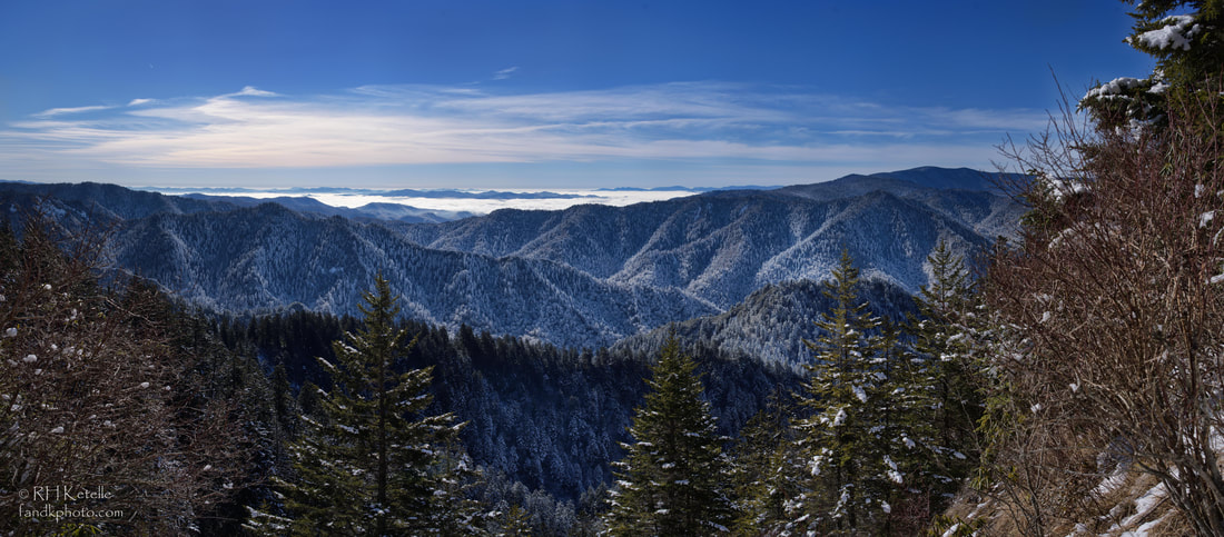 Views from the upper part of the trail extend across the state line at Newfound Gap into western North Carolina. 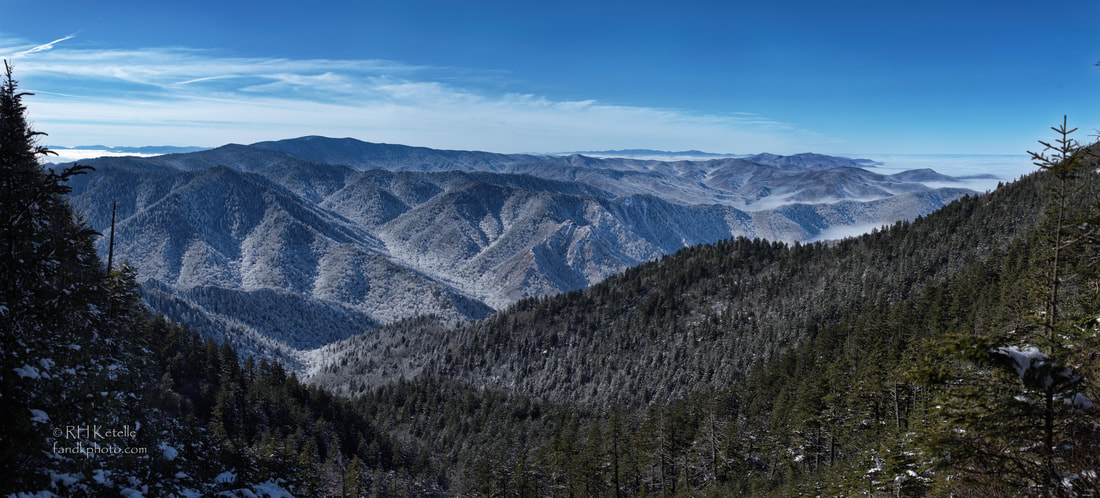 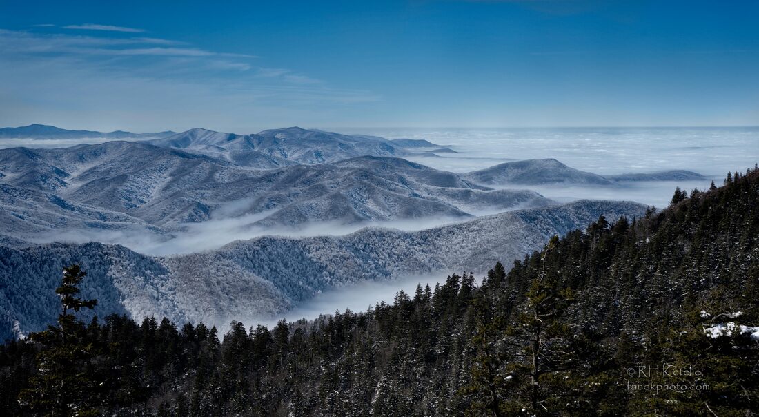 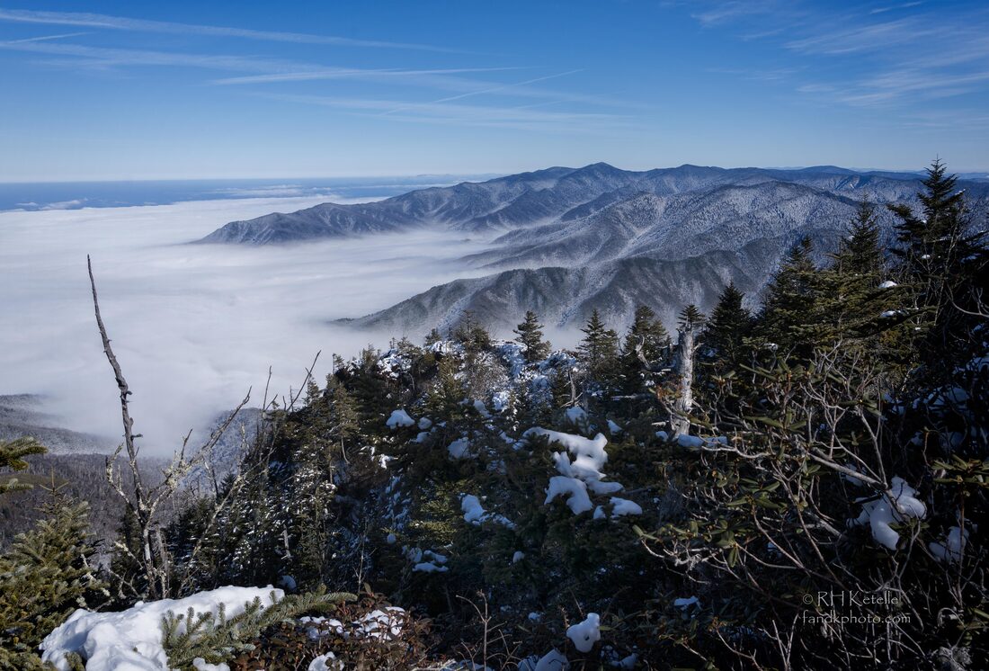 Near the top of Alum Cave trail views extend to the southwest beyond Clingman's Dome and the western half of the Smokies as far as the mountains And views to the northeast from Myrtle Point toward Mt Guyot and mountains beyond along the state line can be spectacular
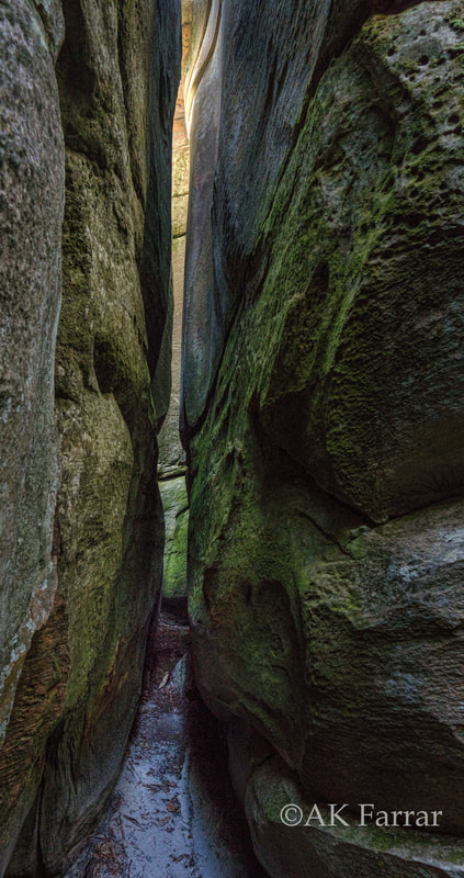
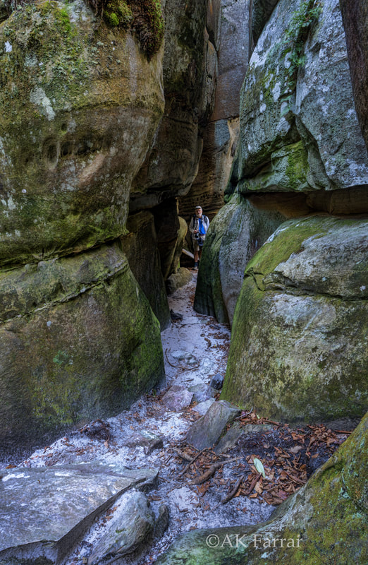
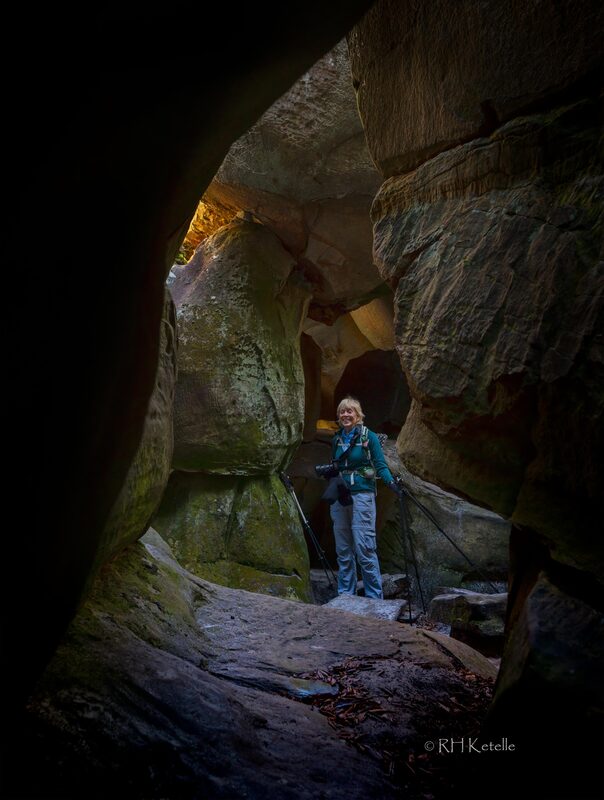
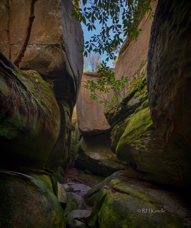
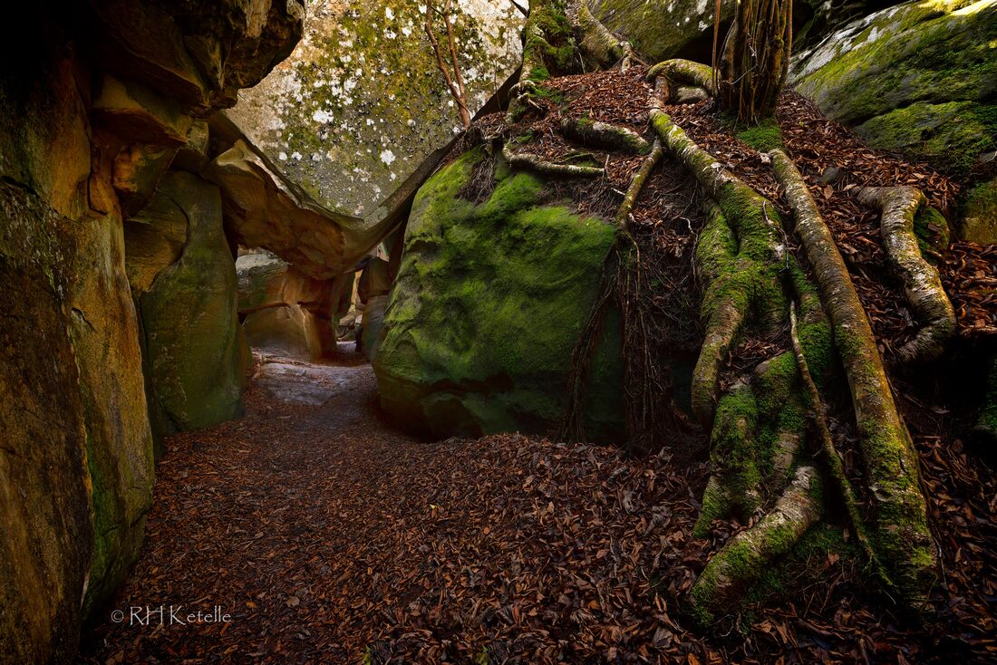
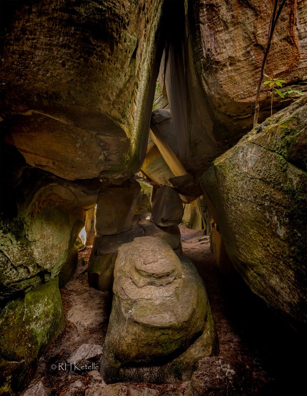
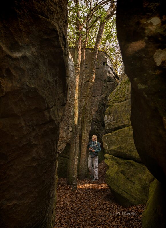
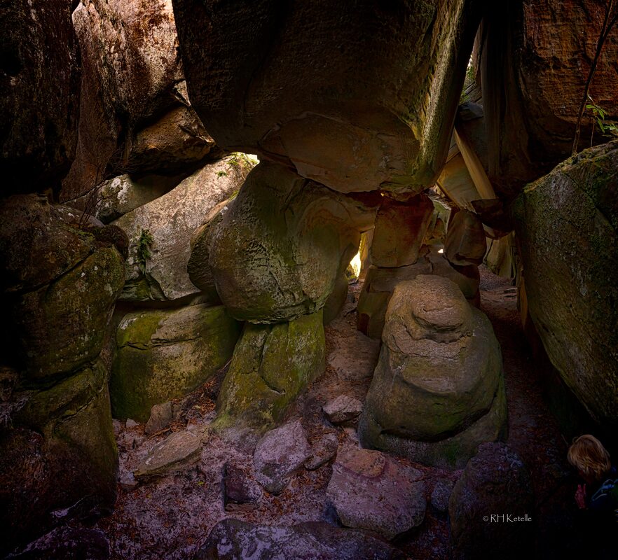
By Ann Farrar and Dick Ketelle The Big South Fork National River and Recreation Area (BSFNRRA) was authorized as part of the 1974 Water Resources Development Act and encompasses 125,000 acres of the Cumberland Plateau in Tennessee and Kentucky. The Big South Fork of the Cumberland River passes through 90 miles of scenic gorges and valleys. There are so many sandstone bluffs, and some of our favorites are the Twin Arches and surrounding rock houses. For us, it is about a two hour drive to the trailhead (I-40 W, US Hwy 127, TN Hwy 154, gravel roads to trailhead). The map below shows the location of this particular trailhead (in the red rectangle) . 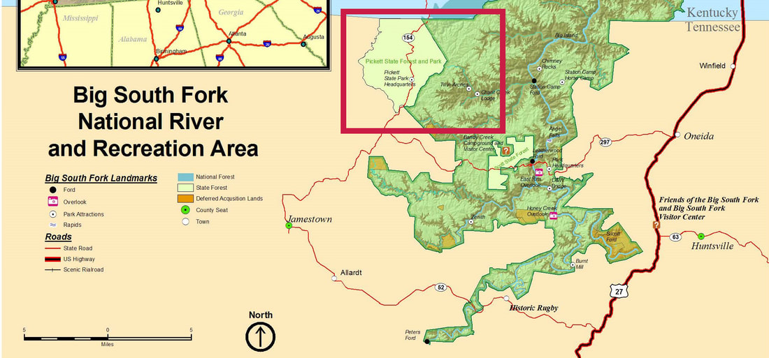 We like to hike a loop trail that includes the Twin Arches, numerous other rock houses and bluffs, Jakes Place, a side trail to Slave Falls, and past Charit Creek Lodge. The hiking loop is shown below, highlighted in red. The Twin Arches are two of the largest arches in the eastern United States and the most spectacular geologic formation in the Big South Fork area. Nowhere else are there two arches so close together and nearly aligned end to end. 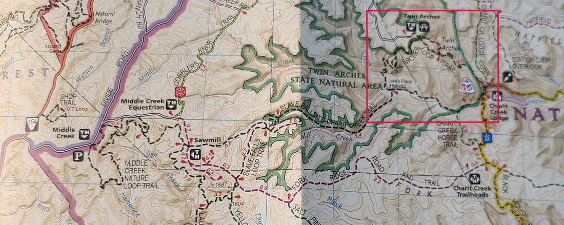 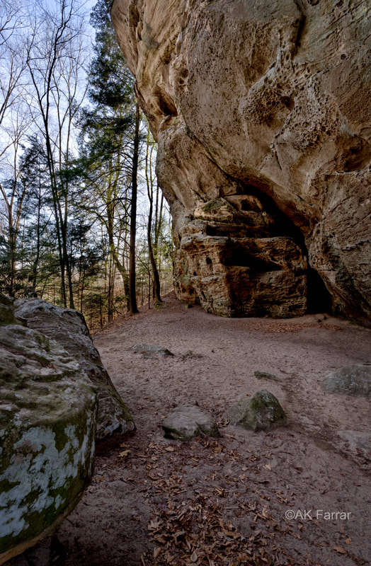 The pictures are from our last hike there which was before Christmas. This is a picture of the side of the South Arch. It is the largest on the Cumberland Plateau, with a span of 135' and a clearance of 70'. This day, we were lucky enough to have the arches to ourselves! So we could take time to capture the composition we wanted. 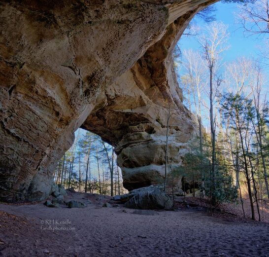 The size of the arches and the nearby trees makes getting good photographic compositions a challenge. 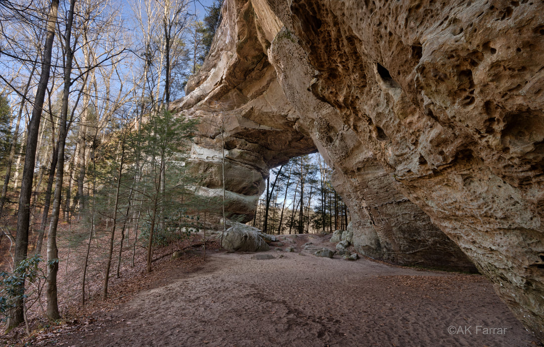 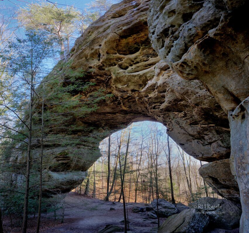 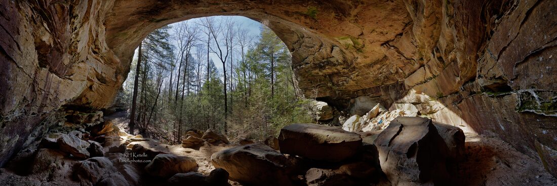 Dick likes to make panorama sequences while under the many rock-house ceilings to capture the feel of the places. This rock-house had nice illumination from the near-solstice winter sun. If you search, you will see Ann sitting in the sun. 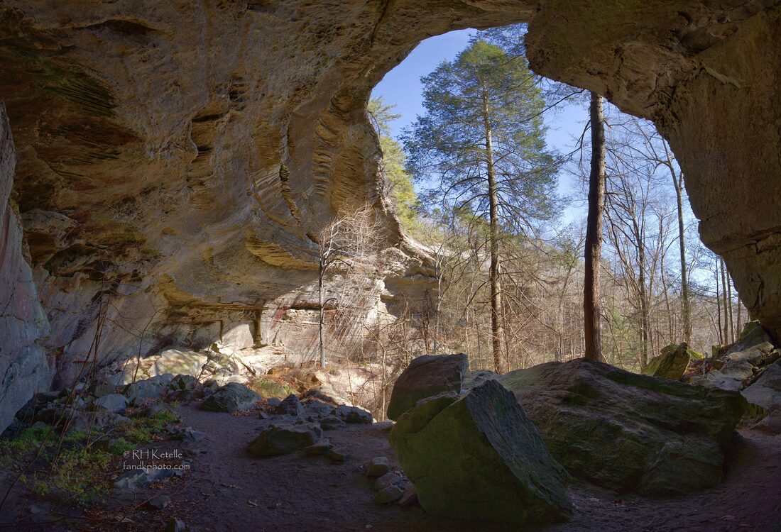 That Native Americans used these rock-houses before European settlers invaded the area is evidenced by the presence of "hominy holes". These are small indentations in some of the scattered boulders where mortar and pestel type activities to crush acorns and probably other nuts to prepare them for cooking for food. 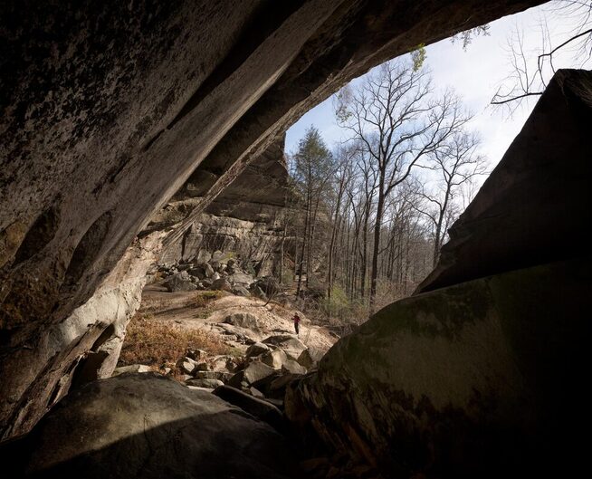 There is a coal seam that lies at the base of this massive sandstone bed. Water seeps through the coal, which is naturally very fractured, and in some areas water trickles across the ground and through the rocks. Interesting plants can survive in these isolated wetland pockets in the otherwise dry, sandy soils. 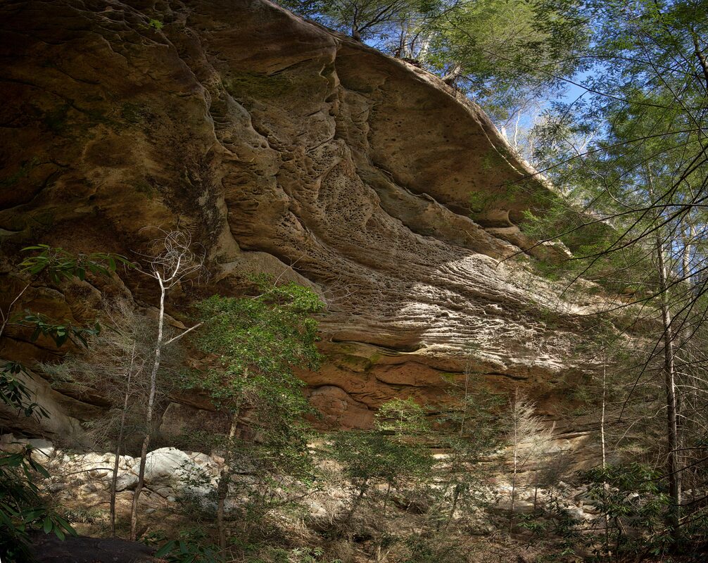 The weathering surfaces, and inter-layered sandstone beds create endlessly interesting faces on the rock-house bluffs. 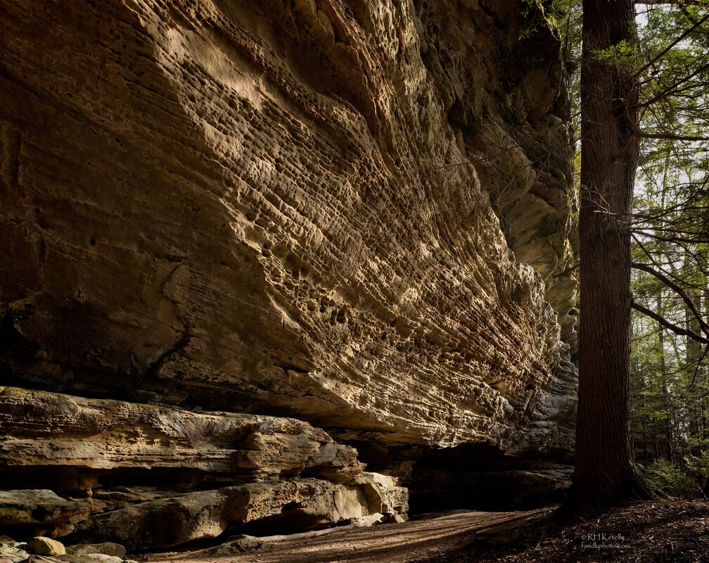 The weathering patterns consisting of holes and pockets are referred to as "tafoni" that form through complex physical and chemical weathering processes in the granular sandstones. 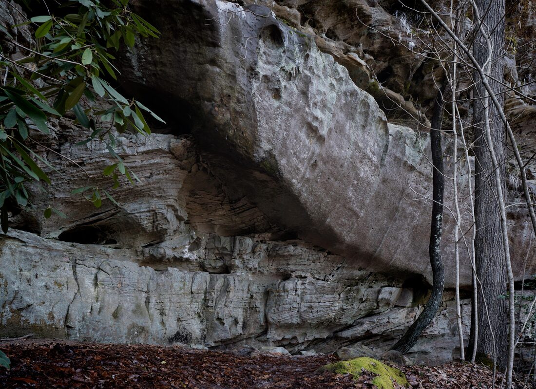 The apparently massive sandstone comprises a wide range of depositional features that provide clues to the environments at the time the sand was laid down. Here we see relatively flat beds at the bottom of the bluff with some cross bedding indicative of deposition in a low to moderate flow current environment. Overlying the bottom layers, and cutting into them, lies the big, nearly featureless brown sandstone bed. That bed is indicative of a cross-cutting channel that eroded down into the underlying sand beds and then was infilled with sand that exhibits little sign of the beds within its thick body. These are among the things that geologists ponder when wandering the woods. 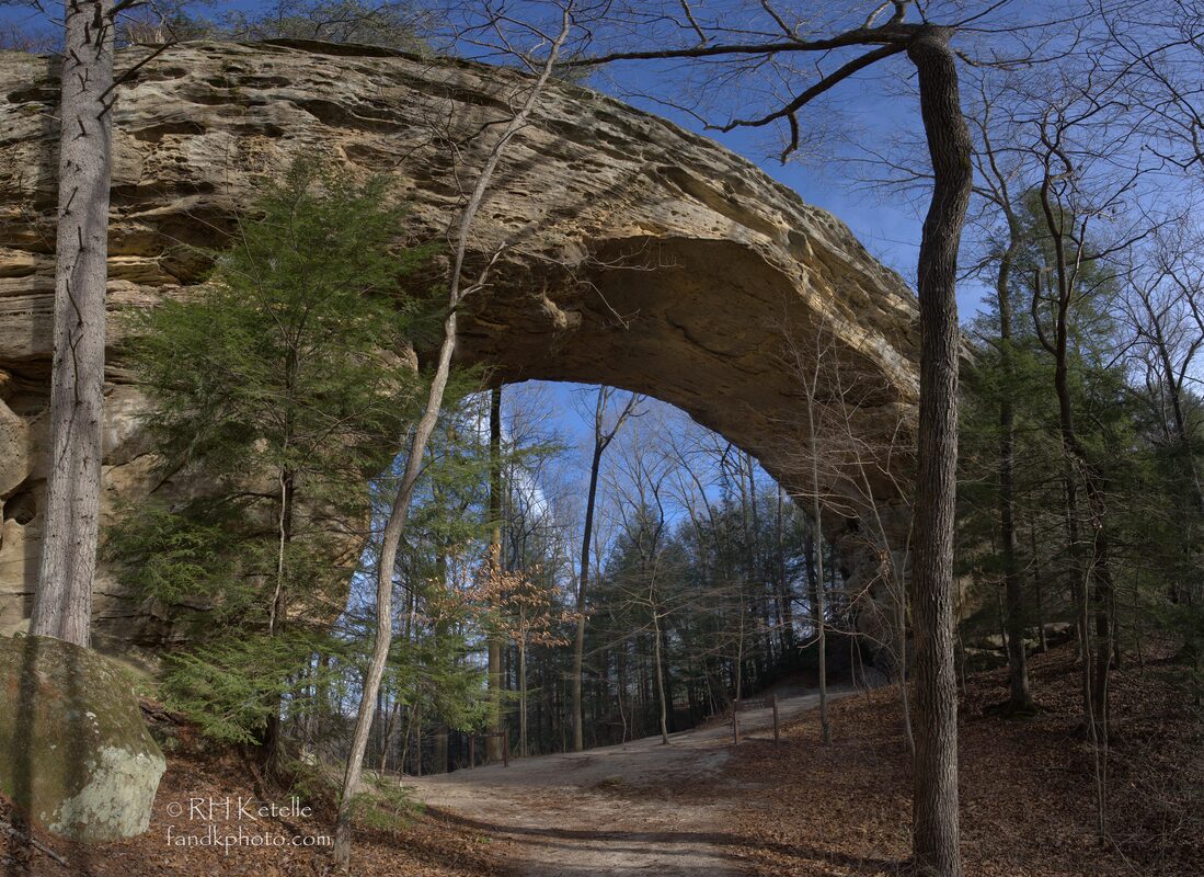 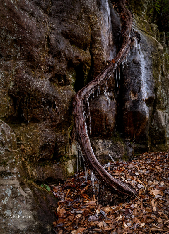 It was cold the day we hiked and we loved seeing the icicles, as well as the arches!! By Ann Farrar and Dick Ketelle We explored a new area to us a couple days ago -- the Channels State Forest. It is on State Hwy 80 in southwest Virginia. The Virginia Department of Forestry purchased this land from The Nature Conservancy (TNC) in 2008. TNC had purchased the property a few years earlier for the purpose of protecting and conserving this resource. Within the boundary of the ~4,800-acre property is a 721-acre parcel that has been dedicated as the Channels Natural Area Preserve under the provisions of the Natural Area Preserve Act of 1989 to be managed by the Department of forestry in partnership with the Department of Conservation and Recreation. 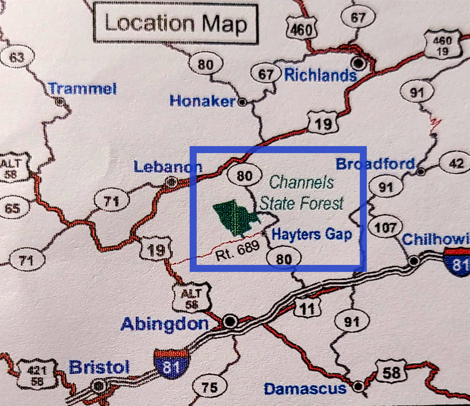 The area highlighted in blue, in the map above, shows the location of Channels State Forest on Hwy 80. 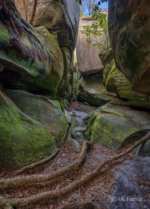 The preserve name is derived from the maze-like system of sandstone crevices and boulders that occur near the summit of Middle Knob on Clinch Mountain. The Channels were likely formed while the high-elevation sandstone cap was under the influence of permafrost and ice wedging during the last ice age. These forces shattered and enlarged joints in the sandstone caprock. As you can image, Dick was "in his element" examining and exploring the maze!! It brought back memories to both of us of scrambling through Mahoosuc Notch on the Appalachian Trail in Maine. 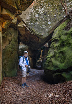 The hike to The Channels is about 3 miles (6 miles roundtrip) and ~1,200' of elevation gain on the Brumley Mountain Trail. The trailhead is at the top of the mountain on Hwy 80. On the trail, you will pass an old fire tower, no longer accessible, before the rock maze entrance. Once in The Channels, we probably spent a couple hours walking around, taking pictures, and enjoying lunch on top of one of the giant boulders in the sunshine. We had so much fun exploring the maze!!! 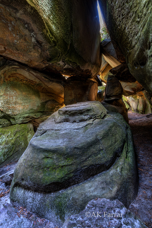 There is a small parking lot at the trailhead and no parking is allowed on the road. We arrived in the morning and had no problem finding a parking place, but it was more crowded in the afternoon. There area is only open during daylight hours, and it seems to be enforced with monitoring at the trailhead later in the day. "Leave no trace" is practiced at this location; no restrooms or trash containers are available
Our Journey to Middle Earthby Ann Farrar Dick has been a Volunteer Trail Maintainer for most of his life. I became an AT Trail Maintainer after the first National Trails Day in the Smokies, right after I started section hiking the AT. [In fact, Dick and I met while maintaining the AT, but that is a story for another blog post!!] I am no longer able to do any of the hard work, because of my back, but I can take pictures of all the hard work that is accomplished, paint blazes, and cut back small branches. I always enjoy being out hiking on the trail and giving back, even in a small way. This past Sunday I went with Taylor Weatherbee and Dick, both volunteers and certified Sawyers, as they removed A LOT of blowdowns on the AT in the Nantahala National Forest. [NOTE: The Smoky Mountains Hiking Club, SMHC, is responsible for volunteer trail maintenance of 100 miles of trail in the Great Smoky Mountains National Park and the national forest.] The three of us were on the AT between Wright Gap and the Jump Up. 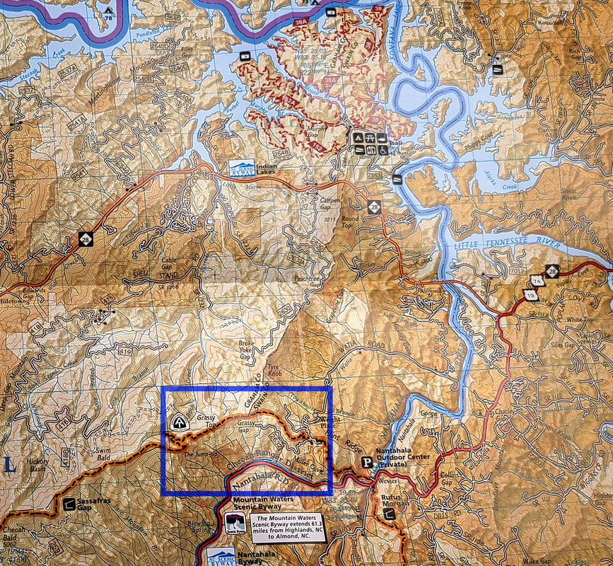 The area highlighted in blue, in the map above, is the section we were hiking and clearing. This post includes pictures and a video from just a few of the blowdowns they removed. They completed a TON of work and were thanked by all the AT South bounders we met while working. It was a great day in the mountains, including having lunch on the Jump Up and enjoying the fantastic view!! 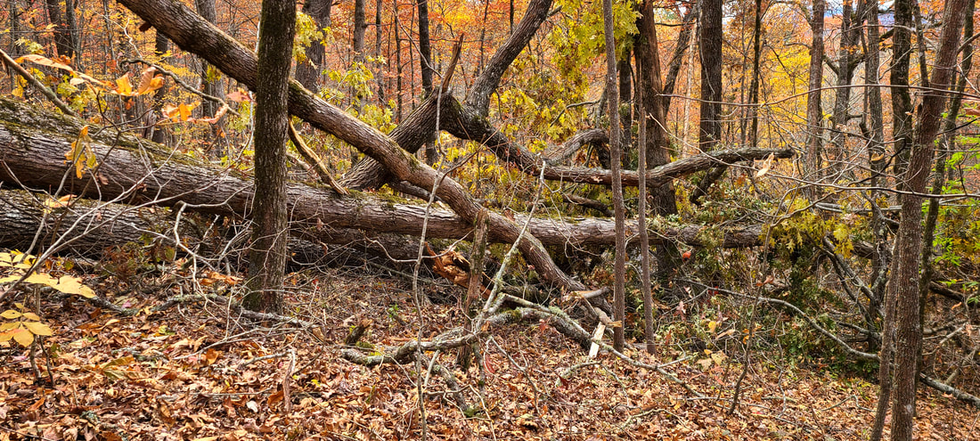 This is the "before" picture of the biggest mess they had to clear from the trail. And yes, the trail goes right through the middle of this massive blowdown of at least four BIG oak trees! If any of you are familiar with this section of the AT, this mess was within sight of the Grassy Gap backcountry campsite. 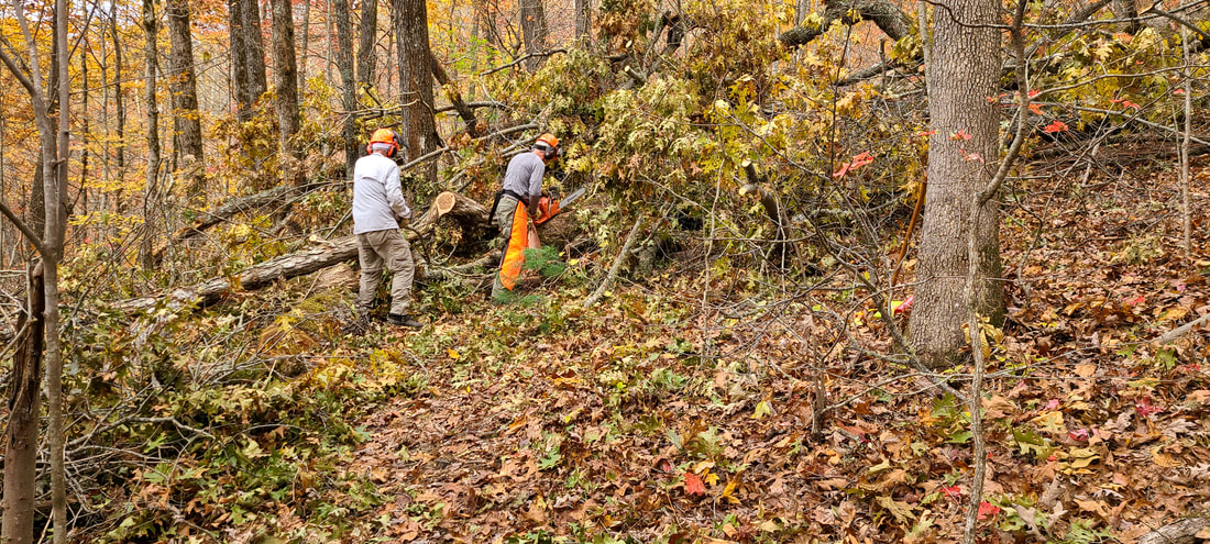 Whenever we reached an area to clear, we stopped and the two of them talked about their plan while getting out their gear and getting ready. They had one chainsaw on this trip and took turns using the saw, while the other moved the cut branches out of the way. Taylor is using the saw in this picture while Dick removes the cut branches and debris. Note that the Sawyer always wears chaps, and they both wear hard hats with face and ear protection. The Sawyer also wears long sleeves while sawing. 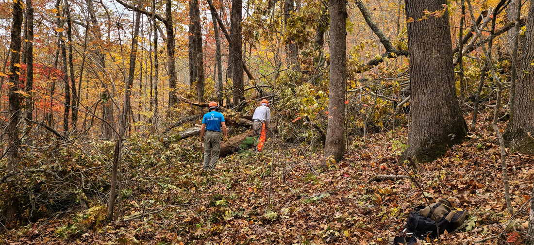 Now Dick is using the saw while Taylor removes debris. They switch often to give each other a break from each job. 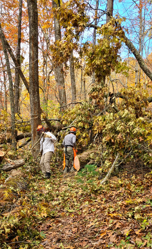 This was the first time I had hiked with Dick and Taylor while working. I was really impressed with how well they work together clearing the trail. 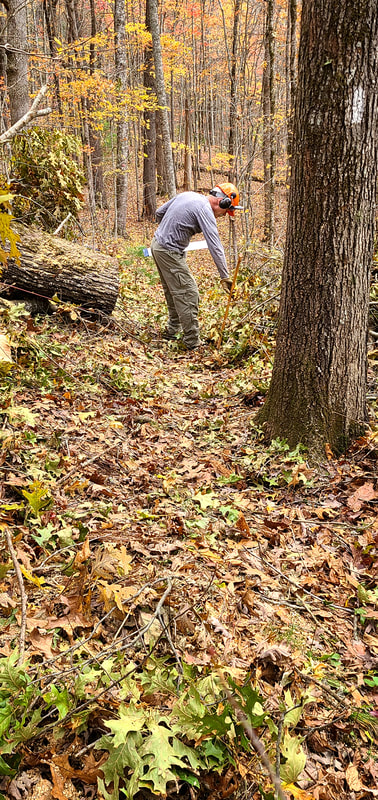 Finally, the trail is clear!! It doesn't even look like the same place! The picture is taken from the southbound side of the AT, while the "before" picture was taken from the northbound side of the trail. Great work guys!!! 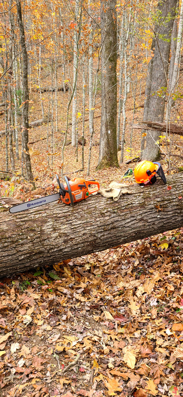 One of the things I did was scout ahead to see if there were other blowdowns close by. That way they knew if they should just carry their gear to the next work site, instead of loading up their packs. I didn't have to go very far to find this one. It was about 100 yards from the last big mess. They rested their saw on the log while going back to get their packs and other gear. 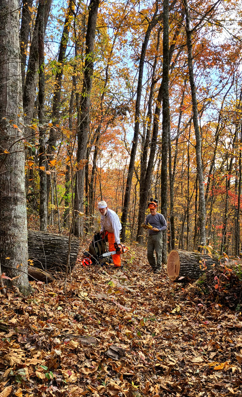 After the last blowdown, this one went very quickly. The trail is clear again!! 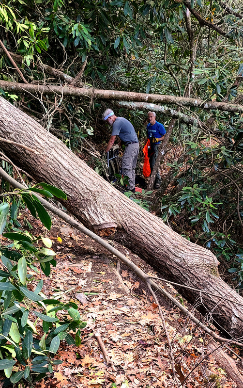 There were too many blowdowns to capture all of them for this blog post, but this one was close to the Jump Up and especially interesting because of the angle on the side of the mountain and across the trail. Logs like this are fairly common on the AT since much of the trail is on mountain slopes. Dick and Taylor use wedges and angle cuts so the log sections can be rolled or levered apart. They also carry a spare bar and chain just in case things don't go as expected and a severe bind occurs. It is an education for me to hike with them and see how they tackle different problems. 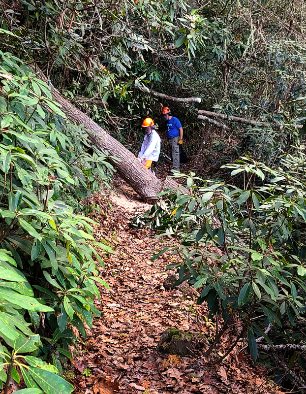 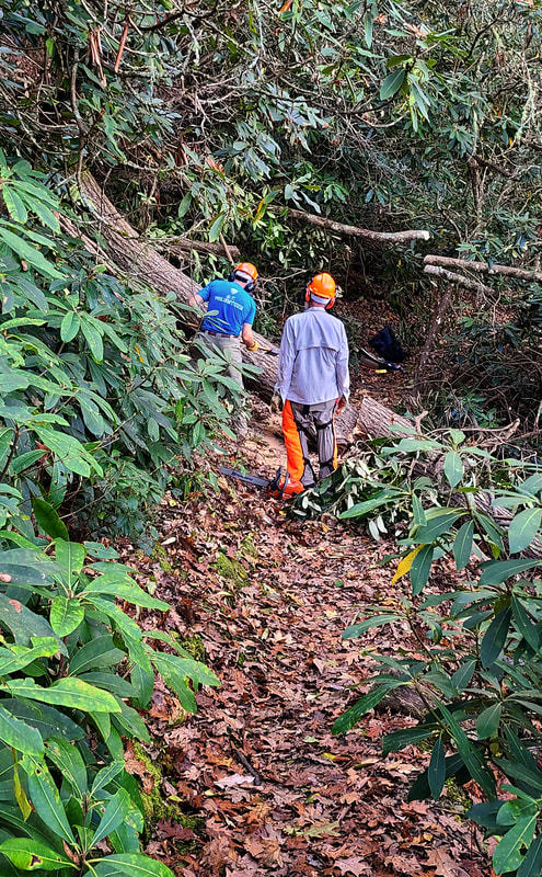 They had to use their chain saw, wedges, and an ax to get this log off the trail. 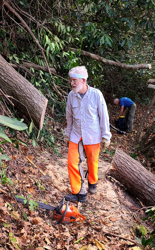 It is always a good feeling to walk through the open trail again!!! 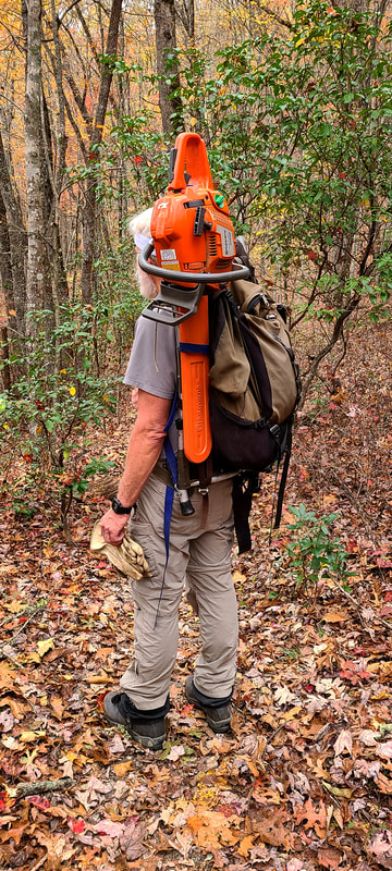 Many have asked how the saw is carried into remote sections of the trail. So this is how you carry your chain saw on the trail!!! Click on this video to watch Taylor and Dick in action!!! 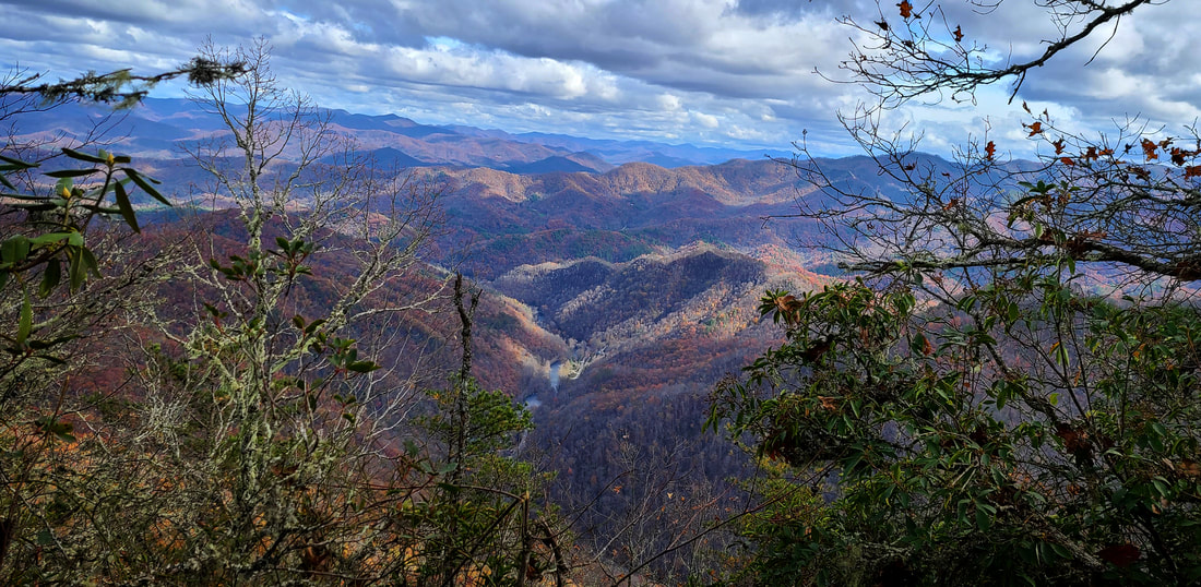 We took a break mid-day to enjoy lunch and the view from the Jump Up. It was an awesome day with an awesome amount of work completed. Thanks to all the trail maintainers for all your hard work!!!
|